Background and Research Summary
Welcome to the research background portal. Here you can view the why and how of this project/dissertation.
Detailed data for this project can be found under the "Ice Shelf Change" and "Instructional Scripts" pages.
Abstract
As the world’s largest cryospheric region, Antarctica is constantly enduring dynamic stages of ice growth/loss. These changes mainly occur on the continent’s coastline, 75% of which is made up of ice shelves. Calving in these regions has long been recorded as a major threat to the stability of ice shelves and the overall rate of ice mass reduction. Its unpredictable nature is reflected through the fluctuating glacial ice dispersion in the Antarctic Peninsula (AP), West Antarctic Ice Sheet (WAIS), and East Antarctic Ice Sheet (EAIS). Ice shelf collapse resulting from calving events is an important reflection of current environmental forcings. In addition, calving can create devastating and lasting effects on the grounded ice of glaciers, leading to sea level rise. Overall, this project is the first to create a comprehensive database of calving front locations, and their area changes, in all three sectors of Antarctica (AP, EAIS, and WAIS). As a standardized measurement of calved distances, this research utilizes the most recent MODIS satellite imagery available, and plots/traces them individually in QGIS. Analysing the ice shelves on an annual basis, for the past 10 years, provides an innovative and dense collection of circum-Antarctic calving data.
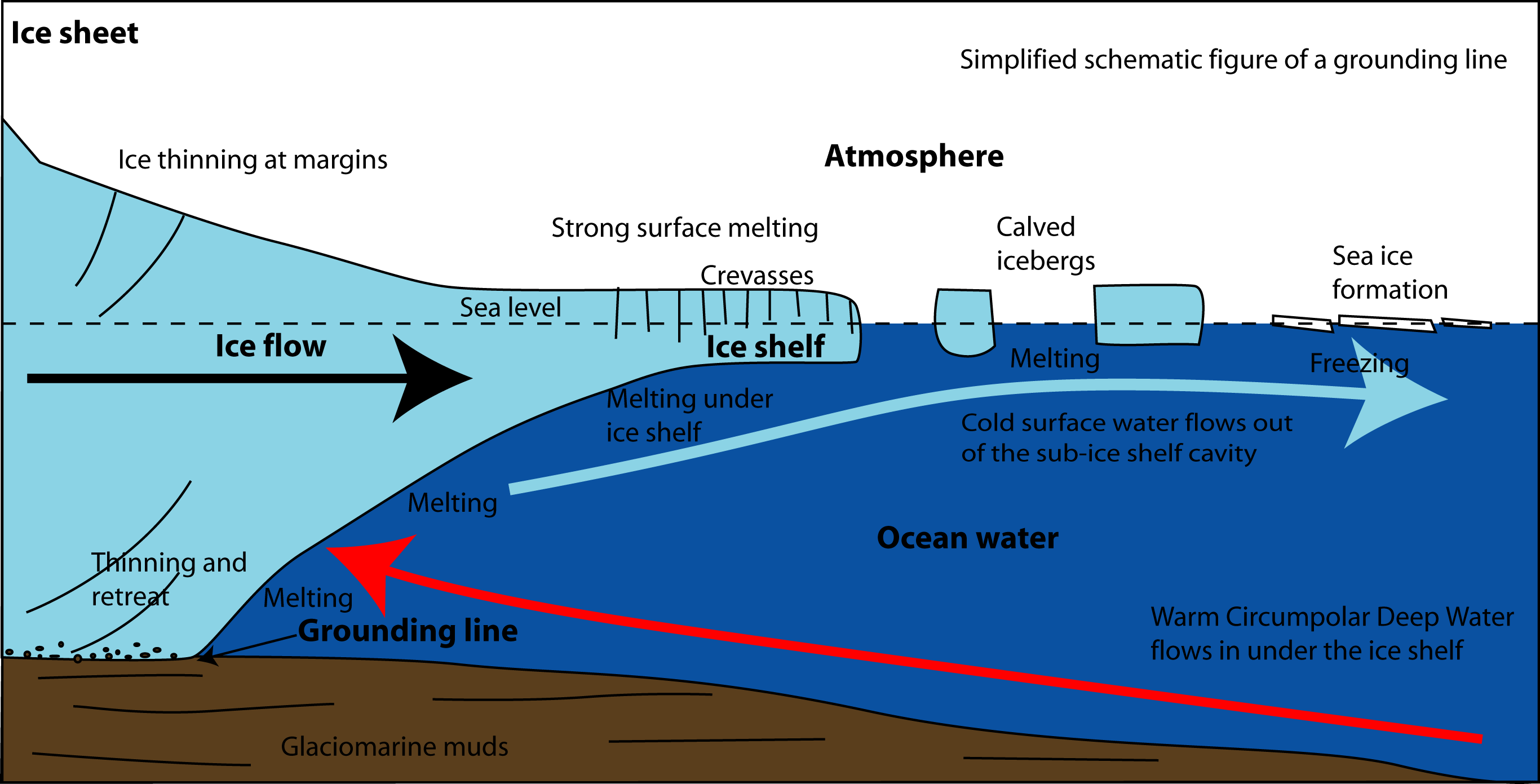 Ice Shelf diagram with inward sloping bedrock and ablation through grounding line erosion, shelf melt, and calving. Citation
 Scientific Rationale
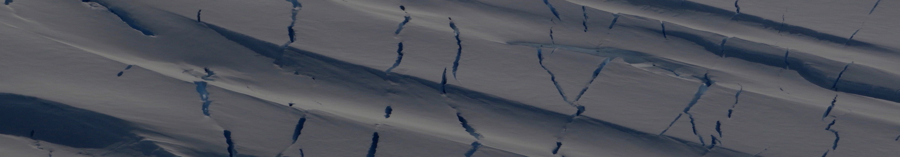
Cryospheric ice loss, specifically through calving events in Antarctica, is a phenomenon that scientists are fascinated by but have yet to fully understand. Evidence of calving is shown through both the drastic migration of land-based glacial fronts, as well as the concerning global rise in sea levels (Benn et al., 2007) (Shepherd et al., 2012). Calving occurs along Antarctica's coastline and is the breaking off of large glacial sections to form icebergs. The mysteries of calving continue to exist because it is neither a methodical nor predictable form of ablation (Dalrymple et al., 2012). The high level of calving front location uncertainty also makes it impossible to generalize the ice shelf patterns of an Antarctic region. As this project proves, individual ice shelves are constantly fluctuating in both their stability and rates of accumulation/ablation, creating unreliable patterns for the entire continent (Rignot et al., 2013). For this reason, ice shelves need to be individually analysed on a year-to-year basis in order to understand what specifically may be the cause of ice migration in that region. Historical calving front data is crucial for this process because it provides background on ice shelf susceptibility to ice loss or gain. However, this project remains innovative because the existing research in this field either focuses on one or two individual ice shelves/glaciers in high-resolution detail or evaluates large sections of coastline on a generalized/low-resolution analysis (Baumhoer et al., 2018). According to Baumhoer et al., “No review paper exists that allows a comprehensive overview on available ice shelf and glacier front positions along the Antarctic coastline” (2018, p. 3). As a remedy, this project focuses on calving around the entirety of the continent to track and measure specifical areal ice migration on an in-depth level. This is to help understand why calving occurs and where it may happen again.
Objectives
This project aims to create a cohesive calving front dataset for the entirety of Antarctica. Spanning across the past 10 years, the measurements collected will provide up-to-date information on Antarctica's major ice shelves. The best quality of analysis will be achieved through the collection and observation of MODIS satellite imagery. Fronts are currently being traced from this optical imagery in QGIS, sourcing Quantarctica data as the Antarctic basemap. In terms of regions, ice shelves will be studied in all three sectors of the continent (AP, EAIS, WAIS). In the Antarctic Peninsula, Cook et al., 2005, created a comprehensive time-series of ice-front migration from 1940 to 2002 around the Peninsula. This data, was then updated by Cook and Vaughan (2010) to include data from 2002 to 2009. Cook's collection is a foundational layer of research for the AP, providing a strong starting point for consistent and continued CFL analysis. Both the East and West Antarctica ice sheets will endure a similar approach by either finding and updating historical data, or just providing original calving data starting in 2009. Overall, calving fronts allow for the measurement of an ice shelf's annual area, as well as the difference/rate of area change per year.
The specific objectives for this research include:
1. Extract, upload, and analyze MODIS satellite imagery in QGIS for the Antarctica Peninsula from 2009- 2018/19, update Cook and Vaughan’s (2010) time-series dataset.
2. Extract, upload, and analyze MODIS satellite imagery for West and East Antarctica from 2009- 2018/19. Depending on historical data availability, this will either update existing calving front migration data or, if there's no previous CFL's, create baseline data for the ice shelves starting in 2009.
3. Measure the area of ice shelves per year, as well as the annual distance between calving front locations. From this data, calculate ice shelf percentage growth/recession from 2009-2018/19, migration rates, and the time period of the largest ice shelf change, over the past 10 years.
---------------------------------------------------------------------------------------------------------------------------------------------- ----------------------------------------------------------------------------------------------------------------------------------------------References
Baumhoer, C. A., Dietz, A. J., Dech, S., and Kuenzer, C. 2018. Remote Sensing of Antarctic Glacier and Ice-Shelf Front Dynamics—A Review. Remote Sensing. 10(1445), pp.1-28.
Benn, D. I., Warren, C. R., and Mottram, R. H. 2007. Calving processes and the dynamics of calving glaciers. Earth-Science Reviews. 82(3-4), pp.143-179.
Cook, A. J., Fox, A. J., Vaughan, D. G., and Ferrigno, J. G. 2005. Retreating glacier fronts on the Antarctic Peninsula over the past half-century. Science. 308(5721), pp.541- 544.
Cook, A. J., and Vaughan, D. G. 2010. Overview of areal changes of the ice shelves on the Antarctic Peninsula over the past 50 years. The cryosphere. 4, pp.77- 98.
Dalrymple, R.A., Breaker, L.C., Brooks, B.A., Cayan, D.R., Griggs, G.B., Han, W., Horton, B.P., Hulbe, C.L., McWilliams, J.C., Mote, P.W. and Pfeffer, T. 2012. Sea-level rise for the coasts of California, Oregon, and Washington: Past, present, and future. National Research, Council the National Academies Press, Washington DC.
Rignot, E., Jacobs, S., Mouginot, J., and Scheuchl, B. 2013. Ice-shelf melting around Antarctica. Science. 341(6143), pp.266- 270.
Shepherd, A., Ivins, E., Rignot, E., Smith, B., Van Den Broeke, M., Velicogna, I., Whitehouse, P., Briggs, K., Joughin, I., Krinner, G., and Nowicki, S. 2018. Mass balance of the Antarctic ice sheet from 1992 to 2017. Nature. 558, pp. 219-222.
----------------------------------------------------------------------------------------------------------------------------------------------